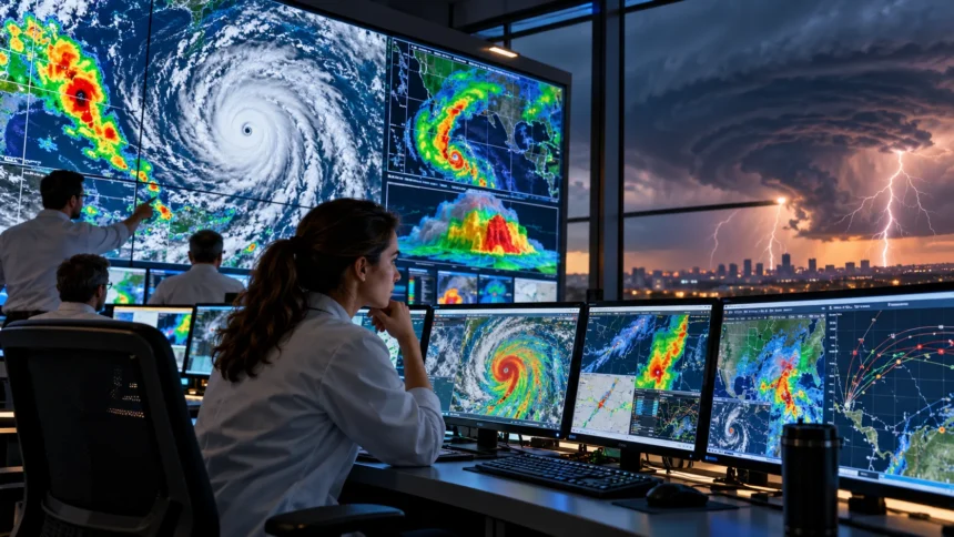
Weather affects almost every part of our daily lives, from deciding what to wear to planning outdoor activities and preparing for dangerous storms. Although the atmosphere constantly changes, scientists can often predict future weather conditions with remarkable accuracy. They use advanced technology, scientific observations, and powerful computer systems to understand how weather patterns develop and move.
But how do scientists predict weather and track severe storms before they reach populated areas? The process involves collecting enormous amounts of atmospheric data, analyzing changing weather conditions, and using mathematical models to estimate what might happen next. Meteorologists also monitor storms in real time to identify possible threats, including heavy rainfall, damaging winds, tornadoes, and hurricanes.
Modern weather forecasting has improved significantly because of satellites, Doppler radar, weather balloons, and supercomputers. These tools allow scientists to study the atmosphere from the ground to high above Earth’s surface. This guide explains how weather prediction works, the technology behind storm tracking, and why accurate forecasts are essential for public safety.
What Is Weather Forecasting and How Does It Work?
Weather forecasting is the scientific process of predicting atmospheric conditions at a particular location and time. Meteorologists study factors such as temperature, humidity, atmospheric pressure, wind direction, and precipitation. By understanding how these conditions interact, they can estimate whether an area will experience sunshine, clouds, rain, snow, or severe weather.
The forecasting process begins with collecting observations from weather stations, satellites, aircraft, ocean buoys, and weather balloons. Scientists combine this information to develop a detailed picture of the atmosphere’s current state. These observations help identify developing weather systems, including cold fronts, low-pressure areas, and regions where thunderstorms may form.
Meteorologists then use computer forecasting models to estimate how atmospheric conditions might change over time. These models apply mathematical equations based on physical laws governing air movement, temperature, and moisture. Forecasters review the results, compare different predictions, and use their expertise to prepare reliable weather information for the public.
How Meteorologists Collect Weather Data
Accurate weather prediction depends on detailed information about existing atmospheric conditions. Meteorologists collect measurements from thousands of observation points around the world, including airports, research stations, ships, and automated monitoring systems. These observations provide essential information about temperature, pressure, humidity, wind speed, and other variables affecting daily weather.
Ground-based weather stations continuously monitor local conditions using specialized instruments. Thermometers measure temperature, barometers record atmospheric pressure, and anemometers measure wind speed. Rain gauges help determine precipitation amounts, while humidity sensors reveal how much water vapor is present in the surrounding air.
Scientists also collect information from locations where conventional weather stations cannot operate easily. Ocean buoys measure marine conditions, aircraft provide atmospheric observations, and satellites monitor large areas of Earth’s surface. Combining these measurements creates a more complete picture of weather patterns and improves the starting information used in forecasting models.
How Weather Satellites Help Predict Storms
Weather satellites are among the most valuable tools used in modern meteorology. These spacecraft observe Earth from orbit and collect information about clouds, temperatures, moisture, and atmospheric movement. Their observations help scientists monitor weather systems across oceans, remote regions, and other locations where ground-based measurements are limited.
Geostationary satellites remain positioned over the same general region of Earth, allowing them to monitor changing cloud patterns continuously. Polar-orbiting satellites travel around the planet and collect detailed observations across different geographical areas. Both types provide valuable information that supports weather prediction and long-term atmospheric monitoring.
Satellite images help meteorologists recognize developing thunderstorms, tropical cyclones, and large weather systems. Scientists can examine cloud-top temperatures, moisture patterns, and changes in storm organization to assess possible development. Satellite observations are especially important over oceans, where hurricanes may form far from land-based weather radar networks.
How Doppler Radar Tracks Severe Storms
Doppler radar is a powerful technology used to monitor precipitation and wind movement within weather systems. Radar equipment transmits radio waves into the atmosphere and analyzes signals reflected by rain, snow, hail, and other objects. These measurements help meteorologists determine where precipitation is occurring and estimate its intensity.
The Doppler effect allows radar systems to measure how precipitation particles move toward or away from the radar. Scientists use this information to identify wind patterns, including rotation within strong thunderstorms. These measurements are particularly valuable when evaluating storms that could produce damaging winds or tornadoes.
Modern dual-polarization radar provides additional information about the size, shape, and characteristics of precipitation particles. This technology helps distinguish rain from hail and identify certain storm features more clearly. By monitoring radar scans over time, meteorologists can track storm movement and issue warnings when dangerous conditions become likely or are occurring.
How Weather Balloons Measure the Upper Atmosphere
Weather balloons help scientists understand atmospheric conditions far above the ground. Each balloon carries a small instrument package called a radiosonde, which measures temperature, humidity, atmospheric pressure, and other variables. As the balloon rises, the equipment transmits measurements that reveal how conditions change with altitude.
These observations are important because weather systems develop throughout different layers of the atmosphere. Ground measurements alone cannot show whether warm, moist air is interacting with colder air higher above the surface. Weather balloon data helps meteorologists recognize atmospheric instability and conditions that may support thunderstorm development.
Many weather agencies launch weather balloons on regular schedules, while additional launches may occur during important weather situations. The collected information improves computer models and helps scientists analyze approaching weather systems. Upper-air measurements remain valuable even as satellite technology and other observing systems continue to develop.
How Computer Models Predict Future Weather
Computer weather models use mathematics and physics to simulate the movement and changing conditions of Earth’s atmosphere. These systems divide the atmosphere into many smaller areas and calculate how temperature, pressure, moisture, and winds may evolve. Powerful computers perform enormous numbers of calculations to generate forecasts covering different locations and time periods.
Before a model begins forecasting, scientists combine observations from satellites, weather stations, aircraft, and other instruments. This process, known as data assimilation, creates an estimate of current atmospheric conditions. The model then uses scientific equations to calculate how weather patterns might develop over the following hours or days.
Different forecasting models may produce slightly different predictions because they use different methods, resolutions, and assumptions. Meteorologists compare these results to identify consistent patterns and possible uncertainties. Computer models provide essential guidance, but professional interpretation remains important when turning complex calculations into useful forecasts for communities.
What Is Numerical Weather Prediction?
Numerical weather prediction is the scientific method of forecasting weather through mathematical calculations. It uses equations describing atmospheric motion, heat transfer, moisture changes, and related physical processes. By solving these equations repeatedly, computer systems estimate how weather conditions may change across different geographical regions.
Scientists use both global and regional numerical weather prediction models. Global models examine large-scale atmospheric patterns across the planet, while regional models provide more detailed information about specific areas. Higher-resolution models may help identify local weather features, including developing thunderstorms and changes caused by mountains or coastlines.
Numerical weather prediction has become increasingly sophisticated as computing technology has improved. Modern systems can process extensive observations and simulate atmospheric behavior in greater detail than earlier methods. However, predictions remain imperfect because the atmosphere is complex, observations contain uncertainties, and small differences can influence future weather development.
How Scientists Predict Severe Thunderstorms
Severe thunderstorm forecasting begins by examining atmospheric conditions that support powerful storm development. Meteorologists look for moisture, unstable air, lifting mechanisms, and changes in wind speed or direction with height. When these ingredients combine in favorable ways, thunderstorms may become strong enough to produce damaging winds or large hail.
Weather models help scientists identify regions where severe thunderstorms could develop later in the day. Forecasters analyze temperature differences, humidity, atmospheric pressure, and wind patterns to understand the potential threat. These assessments help weather agencies prepare outlooks before individual storms begin forming.
Once thunderstorms develop, meteorologists monitor radar and satellite observations to identify changes in their intensity. Rapid cloud growth, strong precipitation, and organized wind patterns may indicate increasing storm strength. Forecasters use these observations alongside reports from trained observers to determine whether severe weather warnings are necessary.
How Meteorologists Detect and Track Tornadoes
Tornado forecasting is particularly challenging because tornadoes can develop rapidly within powerful thunderstorms. Meteorologists first identify atmospheric environments that may support rotating storms, especially when strong wind shear and instability are present. These conditions indicate tornado potential but do not guarantee that a tornado will form.
Doppler radar helps scientists recognize rotation within thunderstorms by measuring differences in wind movement. Certain radar patterns can suggest that a storm contains a rotating circulation. However, radar rotation does not always mean a tornado is present, so meteorologists evaluate additional observations when assessing immediate danger.
Dual-polarization radar can sometimes detect airborne debris associated with a tornado that is already causing damage. Trained storm observers and emergency reports may provide additional confirmation. Because tornadoes can form quickly, communities should follow official warnings and move to appropriate shelter rather than waiting for visible confirmation.
How Scientists Track Hurricanes and Tropical Storms
Hurricanes are powerful tropical weather systems that develop over warm ocean waters under favorable atmospheric conditions. Meteorologists monitor tropical disturbances using satellite images, ocean observations, and computer forecasting models. These tools help scientists identify storm formation, estimate movement, and evaluate whether a developing system may intensify.
Specialized aircraft, commonly called hurricane hunters, sometimes fly into tropical cyclones to collect detailed atmospheric measurements. Their instruments measure pressure, winds, moisture, and other conditions within and around the storm. This information helps improve forecasts of hurricane intensity and provides valuable observations for computer models.
Hurricane tracking involves predicting both the storm’s future path and its possible strength. Meteorologists use multiple forecasting models and uncertainty estimates to communicate where impacts might occur. Because hurricanes can change direction or intensity, forecasts are updated regularly as new observations become available.
How Meteorologists Predict Heavy Rainfall and Flooding
Flood forecasting combines atmospheric science with information about rivers, soil conditions, and surrounding landscapes. Meteorologists estimate how much rain a weather system may produce and where the heaviest precipitation could occur. Hydrologists then examine how rainfall may affect streams, rivers, drainage systems, and nearby communities.
Weather radar helps estimate rainfall intensity and monitor areas experiencing heavy precipitation. Satellite observations provide additional information about cloud systems, while rain gauges measure actual rainfall at ground level. These observations help forecasters determine whether conditions may lead to flash flooding or rising river levels.
Flood predictions also depend on how quickly water enters rivers and drainage systems. Saturated soil, steep terrain, and extensive paved surfaces can increase runoff during heavy rainfall. Combining precipitation forecasts with hydrological models allows scientists to identify areas where flooding may become dangerous.
How Artificial Intelligence Improves Weather Forecasting
Artificial intelligence is becoming an important tool in modern weather prediction. Machine learning systems can examine large datasets and recognize patterns associated with atmospheric changes. Some advanced AI forecasting models estimate future weather conditions using relationships learned from historical observations and previous atmospheric measurements.
AI technology can also support storm tracking by analyzing satellite images, radar measurements, and other environmental information. Automated systems may help identify rapidly developing clouds or unusual precipitation patterns. These capabilities can assist meteorologists in reviewing large amounts of information more efficiently during changing weather situations.
However, artificial intelligence does not eliminate the need for scientific understanding or professional forecasting expertise. AI-generated predictions can contain errors and require careful evaluation, particularly during rare or extreme events. Combining machine learning with physical models, observational data, and human judgment offers opportunities to improve future forecasting systems.
Why Weather Forecasts Are Not Always Accurate
Weather predictions can never be completely certain because Earth’s atmosphere is constantly changing. Small differences in temperature, moisture, or wind conditions may influence how weather systems develop. Even advanced observation networks cannot measure every atmospheric detail at every location and moment.
Forecast accuracy also depends on how far into the future scientists attempt to predict conditions. Short-range forecasts generally benefit from more reliable information about the atmosphere’s current state. Longer-range forecasts become increasingly uncertain because small initial errors can grow as computer models simulate future weather.
Local weather conditions can be particularly difficult to predict when thunderstorms develop quickly or terrain creates complex atmospheric effects. Meteorologists communicate uncertainty through probabilities, forecast ranges, and risk categories. Understanding these uncertainties helps people make informed decisions without expecting every forecast to describe future conditions perfectly.
What Is Ensemble Weather Forecasting?
Ensemble forecasting is a method in which scientists run multiple weather simulations instead of relying on one prediction. Each simulation begins with slightly different atmospheric conditions or modeling assumptions. Comparing the results helps meteorologists understand how sensitive a forecast may be to uncertainty.
When many simulations show similar weather patterns, forecasters may have greater confidence in the general outcome. If the predictions vary widely, there is more uncertainty about possible weather conditions. This approach is especially useful when forecasting storm paths, rainfall amounts, and changing weather systems several days ahead.
Ensemble forecasts can also help meteorologists estimate the range of possible impacts from severe weather. Rather than presenting one outcome as certain, scientists can evaluate different scenarios and communicate potential risks. This information supports planning decisions for communities, transportation services, and emergency management organizations.
How Weather Alerts and Storm Warnings Are Issued
Weather agencies issue forecasts, watches, and warnings to help communities understand developing hazards. A severe weather watch generally indicates that conditions are favorable for dangerous weather within a specified area. A warning indicates that hazardous weather is occurring, imminent, or detected through reliable observations.
Meteorologists evaluate radar images, satellite data, computer forecasts, and reports from trained observers before issuing alerts. They consider the storm’s location, movement, intensity, and expected impacts. In the United States, the National Weather Service provides official warnings for hazards such as severe thunderstorms, tornadoes, and flash floods.
Warnings are distributed through multiple communication systems, including weather applications, emergency alerts, radio, and official forecasting services. People should understand the difference between a watch and a warning before severe weather arrives. Following local emergency instructions and having access to reliable alerts can improve preparedness during dangerous conditions.
How Weather Forecasting Helps Protect Communities
Accurate weather forecasting supports public safety by giving communities time to prepare for hazardous conditions. Advance information about storms can help emergency managers coordinate responses and communicate potential dangers. Early warnings may also allow schools, transportation services, and businesses to adjust activities when severe weather threatens an area.
Forecasting is important for agriculture because farmers depend on weather conditions when planning planting, irrigation, and harvesting. Aviation and shipping industries also rely on meteorological information to evaluate wind, visibility, precipitation, and storm risks. These applications demonstrate how weather prediction supports both everyday decisions and essential economic activities.
Scientists continue improving forecasting systems through better observations, advanced computing, and atmospheric research. These improvements can help communities understand weather risks and respond more effectively. However, public safety also depends on clear communication, accessible warnings, and people taking appropriate action when official alerts are issued.
Conclusion
Scientists predict weather and track severe storms by combining atmospheric observations, advanced technology, and mathematical forecasting models. Weather satellites, Doppler radar, balloons, and ground stations provide valuable information about changing conditions. Meteorologists analyze this data to understand weather patterns and identify possible hazards before they affect communities.
Severe storm forecasting involves continuous monitoring because thunderstorms, tornadoes, hurricanes, and heavy rainfall can change rapidly. Computer models help predict future developments, while real-time radar and satellite observations reveal what is happening. Although forecasts cannot eliminate uncertainty, modern scientific methods provide increasingly useful information for planning and public safety.
Understanding how weather forecasting works helps people appreciate the science behind everyday predictions and emergency warnings. As artificial intelligence, observation networks, and supercomputers continue improving, meteorologists gain new tools for studying the atmosphere. Reliable weather information, combined with appropriate preparation, remains essential for protecting lives and property.
Frequently Asked Questions (FAQs)
How do scientists predict the weather?
Scientists predict weather by collecting atmospheric data from satellites, weather stations, radar, and balloons. Computer models analyze this information using mathematical equations, while meteorologists review the results to produce forecasts.
What technology is used to track severe storms?
Meteorologists use Doppler radar, weather satellites, computer models, weather balloons, and ground observations. These technologies help identify storm development, monitor movement, measure atmospheric conditions, and assess potential hazards.
How do meteorologists know when a tornado might form?
Meteorologists examine atmospheric instability, moisture, and wind shear to identify tornado-producing environments. Doppler radar can reveal storm rotation, but scientists cannot always determine exactly when or where a tornado will develop.
Why are weather forecasts sometimes wrong?
Weather forecasts can be inaccurate because the atmosphere is extremely complex and constantly changing. Small measurement errors, incomplete observations, and unpredictable local conditions can affect computer predictions, especially several days into the future.
Can scientists predict severe storms days in advance?
Scientists can often identify environments favorable for severe storms several days ahead. However, predicting the exact location, timing, and intensity of individual thunderstorms or tornadoes usually becomes more reliable closer to the event.