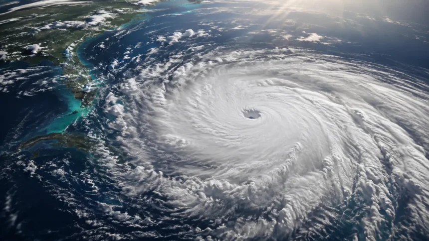
How Do Hurricanes Form? A Complete Guide to Hurricane Development
Hurricanes are among the most powerful weather systems on Earth, capable of producing destructive winds, torrential rainfall, storm surge, and widespread flooding. But these enormous storms do not appear suddenly. They develop through a sequence of atmospheric and oceanic processes that can begin with something as ordinary as a cluster of thunderstorms over warm tropical water. Understanding how hurricanes form helps explain why some tropical disturbances disappear while others grow into dangerous cyclones.
A hurricane is a type of tropical cyclone that develops over warm ocean waters and produces sustained rotating winds around a low-pressure center. The same kind of storm may be called a hurricane, typhoon, or cyclone depending on where it occurs. Hurricanes generally refer to tropical cyclones in the North Atlantic, central North Pacific, and eastern North Pacific once maximum sustained winds reach hurricane strength.
Several environmental ingredients must come together before hurricane formation can occur. Warm seawater provides energy, moist air supplies water vapor, atmospheric instability supports thunderstorm development, and relatively low vertical wind shear allows the storm to remain organized. The Earth’s rotation then helps the system begin spinning around its developing center.
The process can take several days and involves constant interaction between the ocean and atmosphere. As warm water evaporates, rises, cools, and condenses, heat is released into the storm, allowing pressure to fall and winds to strengthen. This guide explains the hurricane formation process step by step, including tropical disturbances, storm structure, ocean temperatures, wind patterns, intensification, weakening, and the conditions scientists watch when forecasting tropical weather.
What Is a Hurricane?
A hurricane is an intense tropical cyclone consisting of organized thunderstorms rotating around an area of low atmospheric pressure. These storms form over tropical or subtropical oceans rather than over cold water or dry land. Their circulation can extend hundreds of miles, while the strongest winds are usually concentrated close to the center of the system.
The term used for a tropical cyclone varies by region, but the underlying weather phenomenon is essentially the same. In the Atlantic and parts of the Pacific, powerful tropical cyclones are known as hurricanes. In the western North Pacific they are commonly called typhoons, while the word cyclone is frequently used in the Indian Ocean and South Pacific.
A tropical cyclone typically passes through several stages before becoming a hurricane. A loosely organized disturbance may develop into a tropical depression once a closed circulation forms. If sustained winds strengthen sufficiently, the system becomes a tropical storm and receives a name. Further strengthening can eventually turn the tropical storm into a hurricane.
What separates hurricanes from ordinary thunderstorms is their organized circulation and ability to continually draw energy from warm ocean water. Thousands of individual thunderstorms may develop within the larger system, yet they work together around a common low-pressure center. This organized structure allows hurricanes to survive for days or sometimes longer while suitable environmental conditions remain available.
Where Do Hurricanes Usually Form?
Most hurricanes begin over tropical ocean waters where sea temperatures are warm enough to support sustained evaporation and thunderstorm activity. The Atlantic Ocean, Caribbean Sea, Gulf region, and eastern Pacific are well-known hurricane development areas. Similar tropical cyclones also form across the western Pacific, Indian Ocean, and parts of the South Pacific.
Hurricanes generally develop several degrees away from the equator rather than directly over it. This happens because the Coriolis effect, which helps create the storm’s rotation, is too weak close to the equator. Farther north or south, Earth’s rotation provides enough influence for developing thunderstorms to begin organizing around a central circulation.
Specific hurricane development zones vary throughout the year because ocean temperatures, atmospheric moisture, and prevailing wind patterns change seasonally. Tropical cyclone activity usually increases when large areas of the ocean become sufficiently warm and atmospheric conditions become more supportive of organized convection.
Not every warm tropical ocean produces hurricanes at the same frequency. Wind shear, dry air, atmospheric stability, ocean heat depth, and large-scale weather patterns all influence whether storms can develop. This explains why two areas with similar surface temperatures may experience very different levels of tropical cyclone activity.
The Basic Ingredients Hurricanes Need to Form
Warm ocean water is one of the most important ingredients for tropical cyclone formation. Surface temperatures of roughly 26.5°C, or about 80°F, are commonly associated with environments capable of supporting development, especially when warm water extends beneath the surface. Warm water increases evaporation and supplies the moisture that fuels intense thunderstorms.
Moist air is another critical requirement because tropical cyclones depend on condensation for energy. When warm, moisture-rich air rises and cools, water vapor condenses into clouds and rain. This process releases latent heat into the atmosphere, warming the storm’s core and encouraging additional rising motion.
Low vertical wind shear is also important. Wind shear describes changes in wind speed or direction with height. Strong shear can push the upper part of a developing storm away from its low-level circulation, disrupting organization. Lower shear allows thunderstorms to remain more vertically aligned around the developing center.
Finally, hurricanes need an initial atmospheric disturbance and enough Coriolis force to produce rotation. A tropical wave, low-pressure area, or cluster of thunderstorms can provide the initial disturbance. When all these ingredients overlap for long enough, a disorganized weather system may gradually develop into a tropical cyclone.
Step 1: Warm Ocean Water Provides the Energy
Hurricane development begins with energy stored in warm tropical oceans. Sunlight heats the sea surface, and some of that heat eventually transfers into the atmosphere through evaporation. The warmer the surface water, the greater the potential for substantial amounts of water vapor to enter the air under favorable conditions.
As evaporation occurs, warm humid air forms directly above the ocean. Because this air is less dense than cooler surrounding air, it tends to rise. Rising air creates lower pressure near the surface, encouraging additional air from nearby areas to move toward the developing low-pressure region.
The ocean must provide more than a thin layer of surface warmth for sustained intensification. Strong winds can mix cooler water from deeper layers toward the surface, potentially reducing the storm’s energy supply. When warm water extends to greater depths, the cyclone may continue drawing heat even after substantial ocean mixing occurs.
This ocean-atmosphere heat exchange helps explain why hurricanes usually weaken after moving over colder water. Without sufficient evaporation and heat transfer from the sea, the storm loses access to its main energy source. Warm ocean water therefore functions like the fuel supply supporting the hurricane’s larger atmospheric heat engine.
Step 2: Warm Moist Air Rises and Creates Low Pressure
Once warm humid air begins rising from the ocean surface, atmospheric pressure near the water decreases. Air naturally moves from areas of relatively higher pressure toward areas of lower pressure. This movement causes additional warm, moist air to flow toward the developing storm center.
As that incoming air reaches the low-pressure area, it also rises. The process creates a continuous cycle in which rising air encourages more surface inflow. When atmospheric conditions are favorable, thunderstorms become increasingly concentrated near the developing circulation.
The rising air expands as it reaches regions of lower pressure higher in the atmosphere. Expansion causes cooling, eventually bringing the air close to saturation. Water vapor then begins condensing into cloud droplets, producing towering clouds and heavy rainfall.
This cycle may begin on a relatively small scale, but repeated thunderstorm development can strengthen the larger low-pressure system. As pressure continues falling, surface winds accelerate toward the center. The developing tropical disturbance gradually becomes more organized if wind shear and surrounding dry air do not disrupt the process.
Step 3: Condensation Releases Heat Into the Storm
Condensation is one of the most important processes behind hurricane intensification. Water vapor contains stored energy known as latent heat. When water vapor condenses into liquid droplets inside thunderstorms, that energy is released into the surrounding atmosphere.
The released heat warms air inside the developing tropical cyclone, causing it to become more buoyant and rise further. This stronger upward motion can reduce surface pressure even more. As pressure decreases, additional air flows inward near the ocean surface, bringing more heat and moisture into the system.
This creates a powerful positive feedback loop. Warm ocean water produces evaporation, moisture rises into thunderstorms, condensation releases heat, pressure falls, and stronger surface winds bring additional moisture toward the storm. As long as environmental conditions remain favorable, this cycle can continue strengthening the cyclone.
Meteorologists sometimes describe tropical cyclones as heat engines because they convert heat from the warm ocean into atmospheric motion. The comparison is simplified, but it captures an essential part of hurricane physics. Energy is transported upward and outward while strong rotating winds develop around the storm’s increasingly organized center.
Step 4: Earth’s Rotation Makes the Storm Spin
Rising air and low pressure alone are not enough to create a hurricane. The system also needs rotation, which is influenced by the Coriolis effect. Because Earth rotates, moving air is deflected relative to the planet’s surface rather than traveling in perfectly straight lines over long distances.
In the Northern Hemisphere, this apparent deflection contributes to counterclockwise circulation around tropical low-pressure systems. In the Southern Hemisphere, tropical cyclones generally rotate clockwise. The direction changes because the Coriolis effect acts differently on either side of the equator.
Very close to the equator, the Coriolis effect is too weak to provide the rotation normally required for tropical cyclone formation. This is why hurricanes rarely develop directly along the equator, even when ocean temperatures are extremely warm and thunderstorms are abundant.
Once rotation begins, incoming air spirals toward the low-pressure center rather than moving straight inward. The circulation becomes increasingly organized as thunderstorms cluster around the center. If the system continues strengthening, distinct structural features such as spiral rainbands, an eyewall, and eventually an eye may begin developing.
Step 5: Thunderstorms Organize Around a Central Circulation
Early tropical disturbances often contain scattered thunderstorms without a clearly defined center. For development to continue, these thunderstorms must become better organized around a common circulation. Persistent thunderstorm activity can gradually strengthen the low-level rotation and create a more clearly defined area of low pressure.
As organization improves, surface winds begin circulating around the center instead of simply flowing randomly through the disturbance. Meteorologists closely monitor satellite imagery, wind observations, pressure measurements, and thunderstorm patterns to determine whether a closed circulation has developed.
Once a system develops an organized closed surface circulation and meets required wind characteristics, it can be classified as a tropical depression. This stage represents an important transition from an ordinary tropical disturbance into a recognized tropical cyclone.
A tropical depression may strengthen rapidly, slowly, or not at all. Its future depends on the surrounding atmospheric and oceanic environment. Warm water, abundant moisture, good upper-level airflow, and limited wind shear can support further development, while dry air, land interaction, or stronger shear can prevent intensification.
From Tropical Depression to Tropical Storm
A tropical depression becomes a tropical storm when its maximum sustained winds reach the threshold used for tropical storm classification. At this stage, the circulation is normally better organized, thunderstorms become more concentrated, and the system is given an official name according to established naming lists.
Naming tropical storms makes it easier for forecasters, emergency agencies, news organizations, and the public to communicate about a specific system. A named storm may still be relatively weak compared with a hurricane, but it can already produce dangerous rainfall, flooding, gusty winds, rough surf, and coastal impacts.
The storm continues drawing warm, humid air inward near the ocean surface. Thunderstorms release heat through condensation, helping maintain a warm core and low central pressure. If the surrounding environment remains favorable, surface winds can increase as the pressure difference between the center and surrounding atmosphere grows.
Not every tropical storm becomes a hurricane. Some encounter stronger vertical wind shear, dry air, cooler water, or land before they can intensify. Others remain in favorable conditions long enough for their circulation and internal structure to strengthen significantly, eventually reaching hurricane intensity.
When Does a Tropical Storm Become a Hurricane?
A tropical storm is classified as a hurricane when its maximum sustained winds reach at least 74 mph, or 119 km/h, under the classification commonly used in the Atlantic and eastern North Pacific. At that point, the storm has developed sufficient organization and wind strength to enter hurricane status.
Hurricanes are commonly categorized from Category 1 through Category 5 according to maximum sustained wind speed. These categories communicate wind intensity, but they do not describe every hazard associated with the storm. Lower-category hurricanes can still produce devastating flooding or storm surge depending on their size, speed, rainfall, and track.
As a tropical storm approaches hurricane intensity, its internal structure often becomes increasingly organized. Strong thunderstorms may form a ring around the center, eventually creating an eyewall. Spiral rainbands extend outward from the core, producing periods of intense rainfall and gusty winds far from the center.
The transition to hurricane status does not represent the end of development. Some hurricanes remain relatively stable, while others strengthen considerably. Under especially favorable conditions, hurricanes can undergo periods of rapid intensification in which their maximum winds increase substantially over a relatively short time.
How the Eye of a Hurricane Forms
One of the most recognizable features of a mature hurricane is the eye, a roughly circular area near the center that can contain lighter winds and fewer clouds than the surrounding eyewall. The eye usually becomes more distinct as a tropical cyclone strengthens and its circulation becomes highly organized.
Air within the eyewall rises vigorously because strong surface winds transport warm, humid air toward the storm center. Some air near the center eventually descends within the eye. As descending air compresses and warms, clouds can evaporate, helping create the relatively clear conditions sometimes observed inside the eye.
The size of an eye varies considerably from one hurricane to another. Some storms develop very small eyes, while others contain much wider central regions. Eye size alone does not determine how dangerous a hurricane is, although changes in eye structure can provide important clues about storm intensity and internal evolution.
A calm eye can create a dangerous misconception during landfall. If the eye passes directly overhead, conditions may improve temporarily before violent winds return from the opposite direction as the other side of the eyewall arrives. People should therefore continue following official safety instructions even if conditions suddenly become calm.
What Is the Eyewall?
The eyewall is the ring of intense thunderstorms surrounding the hurricane’s eye. It usually contains the strongest sustained winds, some of the heaviest rainfall, and the most vigorous upward motion within a mature tropical cyclone. Conditions in the eyewall can be dramatically more dangerous than those inside the eye.
Warm, moisture-rich air spirals inward near the ocean surface before rising rapidly within the eyewall. Strong condensation and heat release support powerful thunderstorms, while pressure gradients generate extreme winds. This region represents the energetic core of many intense hurricanes.
The eyewall is not always perfectly symmetrical or stable. Powerful hurricanes may experience eyewall replacement cycles in which a new outer eyewall develops around the original one. The inner eyewall may weaken while the outer ring gradually contracts and becomes dominant.
During an eyewall replacement cycle, maximum wind speeds may temporarily decrease even as the storm’s overall wind field expands. Once the replacement process is complete, the hurricane may strengthen again if environmental conditions remain supportive. These structural changes are closely monitored because they influence both intensity and the geographical extent of damaging winds.
What Are Hurricane Rainbands?
Hurricane rainbands are curved bands of clouds and thunderstorms that spiral outward from the central circulation. They can extend hundreds of miles from the eye and produce bursts of heavy rainfall, strong wind gusts, lightning, and occasionally tornadoes well before the storm’s center arrives.
Rainbands form as moisture-rich air spirals into the broader hurricane circulation. Thunderstorms tend to organize into curved bands because of the storm’s rotation and internal airflow patterns. Areas between major bands may experience temporary periods of lighter rain and weaker winds.
These bands can contribute substantially to hurricane flooding, particularly when they repeatedly move over the same location. A storm does not need to pass directly overhead for outer rainbands to cause serious impacts. Communities far from the center can still experience flash flooding, damaging gusts, and hazardous travel conditions.
Rainband structure also changes as hurricanes interact with surrounding weather systems. Wind shear, dry air, nearby fronts, and land can make precipitation more concentrated on one side of the storm. Forecasters therefore examine the entire circulation rather than focusing only on the location of the eye.
Why Low Wind Shear Helps Hurricanes Strengthen
Vertical wind shear describes changes in wind direction or speed at different heights in the atmosphere. Hurricanes generally develop most effectively when wind shear is relatively low because their thunderstorms can remain vertically aligned with the low-pressure circulation underneath.
Strong wind shear can tilt the storm structure. Thunderstorms may be pushed away from the surface center, separating the source of heat from the main circulation. Once this alignment is disrupted, it becomes more difficult for the tropical cyclone to maintain the efficient feedback process needed for strengthening.
Moderate or strong shear does not always destroy a hurricane immediately, especially if the storm is already powerful. However, sustained unfavorable shear can weaken the circulation, expose the low-level center, and allow dry environmental air to enter important parts of the system.
Meteorologists therefore examine upper-level winds carefully when forecasting hurricane development. A tropical disturbance over very warm water may still struggle if the surrounding atmosphere contains strong shear. Conversely, a well-organized system experiencing low shear can sometimes intensify quickly when other conditions are also favorable.
Why Moist Air Matters for Hurricane Development
Tropical cyclones depend on abundant atmospheric moisture because their thunderstorms require large quantities of water vapor. Moist air flowing toward the circulation supports deep clouds, heavy rainfall, and repeated condensation, which releases the heat needed to maintain the hurricane’s warm-core structure.
Dry air can disrupt this process when it becomes mixed into the storm. Thunderstorms may weaken or become less organized because evaporation cools parts of the atmosphere and reduces sustained convection. The impact can be especially noticeable when dry air penetrates close to the developing circulation.
Large regions of dry, dusty air sometimes move across tropical oceans and interact with potential tropical cyclones. These air masses can create less favorable conditions for development, although their exact effects depend on numerous factors including wind patterns, moisture distribution, and the organization of the disturbance.
A humid environment does not guarantee hurricane formation, but it removes one major obstacle. Tropical cyclone development requires several ingredients at the same time. Warm water, sufficient moisture, low wind shear, atmospheric instability, initial rotation, and favorable upper-level conditions must work together rather than independently.
How Hurricanes Strengthen Over Warm Water
Once a hurricane forms, continued access to warm ocean water can support additional strengthening. Strong surface winds increase evaporation and transfer heat and moisture from the ocean into the lower atmosphere. This energy feeds thunderstorms within the storm’s inner circulation.
As central pressure falls, the pressure difference between the eye and surrounding atmosphere may increase. Air accelerates toward the lower pressure, creating stronger surface winds. These stronger winds can then increase ocean evaporation, reinforcing the feedback loop when environmental conditions remain favorable.
Ocean heat content is important because a hurricane can stir the water beneath it. If colder water lies close to the surface, intense winds may mix that cooler water upward, limiting energy available to the storm. Deeper layers of warm water can reduce this self-cooling effect and sometimes support more sustained intensification.
Storm motion also matters. A slowly moving hurricane can churn the same ocean region for a longer time, potentially bringing cooler water to the surface. Faster-moving storms may encounter fresh areas of warm water more continuously, although many additional atmospheric factors determine whether the hurricane ultimately strengthens or weakens.
What Is Rapid Intensification?
Rapid intensification describes a significant increase in a tropical cyclone’s maximum sustained winds over a relatively short period. It is one of the most challenging aspects of hurricane forecasting because rapid strengthening close to land can dramatically change expected impacts and emergency preparation needs.
Very warm ocean water, high ocean heat content, moist surrounding air, low wind shear, and a well-organized inner core can all contribute to environments favorable for rapid intensification. However, the exact timing and magnitude of strengthening remain difficult to predict because hurricanes contain complex internal processes.
Small structural changes within the eyewall can influence how efficiently a storm converts ocean energy into stronger winds. Interactions between thunderstorms, surface fluxes, upper-level outflow, ocean conditions, and environmental winds can produce substantial changes over relatively short periods.
Forecasting rapid intensification has improved as satellites, aircraft observations, ocean measurements, radar, and numerical weather models have become more sophisticated. Even so, uncertainty remains. This is one reason people in hurricane-prone regions are encouraged to prepare before a storm reaches its strongest predicted intensity.
Why Hurricanes Cannot Form Over Land
Hurricanes depend on warm ocean water for their main supply of heat and moisture. Once a storm moves inland, evaporation from the ocean surface is removed from most or all of its circulation. Without continuous access to this energy source, thunderstorms surrounding the center usually begin weakening.
Land also creates greater surface friction than the open ocean. Mountains, forests, buildings, and uneven terrain interfere with low-level airflow, disrupting the smooth circulation of the storm. Mountainous terrain can weaken tropical cyclones particularly quickly by breaking apart the organized wind structure.
Although hurricanes weaken over land, they can remain extremely dangerous. Powerful winds may continue for many hours, while tropical moisture can produce enormous rainfall totals far inland. Flash floods, river flooding, landslides, and tornadoes may occur even after the storm is no longer officially classified as a hurricane.
Some tropical cyclones cross relatively narrow land areas and then move back over warm water. If their circulation remains sufficiently intact, they may reorganize and strengthen again. Whether this happens depends on how long the storm spent over land and the environmental conditions waiting over the next body of water.
What Causes a Hurricane to Weaken?
Moving over land is one of the most common reasons hurricanes weaken, but several other factors can reduce their intensity. Cooler ocean water limits heat and moisture transfer, weakening thunderstorms and reducing the energy available to sustain the cyclone’s circulation.
Strong vertical wind shear can also weaken hurricanes by tilting their structure and pushing thunderstorms away from the center. Dry air may enter the circulation and interfere with sustained convection, while stable atmospheric conditions can limit the vigorous rising motion needed for continued development.
Internal changes can cause temporary weakening as well. Eyewall replacement cycles may reduce maximum wind speeds while reorganizing the hurricane’s core. These changes do not necessarily mean the overall threat has disappeared because the storm’s wind field may expand even while peak winds decline.
Interaction with larger weather systems can eventually transform a tropical cyclone into a different type of storm. As hurricanes move toward cooler latitudes, they may lose their warm-core tropical characteristics and become extratropical cyclones. Such systems can still produce damaging winds, heavy rainfall, and significant coastal impacts.
Why Hurricanes Usually Form During Certain Seasons
Hurricane activity is seasonal largely because tropical oceans require time to warm and atmospheric patterns must become favorable. Ocean temperatures generally increase through warmer months, eventually creating larger areas capable of supporting tropical cyclone development.
In the Atlantic, hurricane activity typically becomes more favorable during the period when ocean warmth, moisture, and tropical disturbances are most supportive. Seasonal wind patterns also influence vertical wind shear and the pathways tropical systems are likely to follow across the ocean.
The most active portion of a hurricane season often occurs after several months of sustained ocean warming rather than immediately when summer begins. This lag occurs because the upper ocean stores heat over time, while large-scale atmospheric circulation patterns also evolve throughout the season.
Tropical cyclones can occasionally occur outside their typical seasonal windows. Nature does not follow calendar dates perfectly, and an unusual combination of warm water and favorable atmospheric conditions can sometimes support development earlier or later than expected.
How Meteorologists Track Developing Hurricanes
Meteorologists begin monitoring many systems long before they become hurricanes. Satellite imagery allows forecasters to observe cloud patterns, thunderstorm organization, moisture, and circulation across vast regions where conventional weather stations are unavailable.
When a tropical system becomes more significant, additional observations may come from ocean buoys, ships, radar, weather stations, and specialized aircraft. Hurricane reconnaissance aircraft can measure wind speed, pressure, temperature, moisture, and other conditions directly inside certain storms.
Computer models use current atmospheric and oceanic observations to simulate how a storm may move and change in intensity. Different models can produce different forecasts, so meteorologists compare multiple simulations while considering real-world observations and known model strengths or limitations.
Forecasts are updated as new data become available. Track predictions, intensity estimates, rainfall outlooks, and coastal hazards can all change as scientists learn more about the storm. This is why official forecasts should be checked regularly when a tropical cyclone threatens a populated area.
How Hurricane Categories Work
Hurricanes are commonly classified using a five-category wind scale based on their maximum sustained wind speed. Category 1 represents the lowest hurricane wind category, while Category 5 represents the highest level on the scale. Higher categories generally indicate greater potential for severe wind damage.
The category does not describe every danger associated with a hurricane. Storm surge depends on factors including storm size, coastal geography, track, wind direction, and ocean depth. Rainfall depends heavily on storm speed, moisture supply, terrain, and interactions with other atmospheric systems.
A large Category 1 or Category 2 hurricane can sometimes produce more widespread flooding than a compact higher-category storm. Similarly, a tropical storm may cause catastrophic rainfall if it moves slowly over the same region for an extended period.
For this reason, people should not use hurricane category alone to decide whether a storm is dangerous. Forecast information about rainfall, storm surge, flooding, tornadoes, wind extent, and local evacuation guidance provides a much more complete picture of expected impacts.
Hurricanes and Climate Change
Hurricanes have always been part of Earth’s climate system, and climate change does not mean that every individual hurricane is directly caused by global warming. Tropical cyclone formation still depends on specific weather patterns that vary greatly from storm to storm and season to season.
Warmer oceans can, however, provide more heat and moisture to tropical cyclones when atmospheric conditions support development. A warmer atmosphere can also hold more water vapor, creating conditions that may contribute to heavier rainfall during some tropical storms and hurricanes.
Sea-level rise can increase the baseline from which hurricane-driven storm surge occurs, potentially worsening coastal flooding in vulnerable communities. The exact impacts vary significantly according to coastline shape, local land elevation, storm track, tides, and protective infrastructure.
Scientists continue studying how warming influences hurricane frequency, intensity, rainfall, movement, and rapid intensification. The strongest evidence concerns changes in certain hurricane characteristics rather than a simple claim that climate change produces more hurricanes everywhere. Understanding these distinctions helps keep discussions about tropical cyclones accurate and useful.
Why Hurricanes Are So Powerful
The remarkable strength of a hurricane comes from the enormous amount of heat stored in tropical oceans. A mature cyclone can process vast quantities of water vapor, transferring energy from the sea into the atmosphere through evaporation and condensation.
This energy is organized across a rotating low-pressure system rather than released in one isolated thunderstorm. Thousands of convective clouds can contribute to the circulation, while strong inflow near the surface continually transports warm and humid air toward the storm center.
The pressure difference between the hurricane’s core and surrounding atmosphere produces extremely powerful winds. At the same time, those winds push ocean water toward coastlines, potentially creating destructive storm surge. Heavy tropical rainfall adds another major hazard, particularly when the hurricane moves slowly.
A hurricane’s power therefore comes from several interconnected processes rather than a single cause. Warm water, moisture, low pressure, rotation, condensation, convection, and atmospheric circulation work together, transforming ordinary tropical heat into one of nature’s most organized and energetic weather systems.
Final Thoughts on How Hurricanes Form
Understanding how hurricanes form begins with recognizing the relationship between warm oceans and the atmosphere. Tropical water supplies heat and moisture, warm air rises, pressure falls, and thunderstorms begin developing around an area of disturbed weather. Under the right conditions, these processes become organized into a rotating circulation.
Condensation provides additional energy by releasing latent heat, while the Coriolis effect helps incoming air rotate around the developing low-pressure center. If wind shear stays relatively low and atmospheric moisture remains plentiful, a tropical disturbance can progress through the stages of tropical depression, tropical storm, and eventually hurricane.
Once a hurricane develops, features such as the eye, eyewall, and spiral rainbands can become increasingly organized. Continued access to warm water may allow the cyclone to strengthen, while land, cold water, dry air, or disruptive winds can eventually weaken it.
Hurricanes are complex systems, but their basic formation process demonstrates a powerful connection between ocean heat and atmospheric motion. Understanding that process makes weather forecasts easier to interpret and highlights why scientists continuously monitor ocean temperatures, tropical disturbances, atmospheric moisture, and wind patterns throughout hurricane season.
Frequently Asked Questions
How does a hurricane start?
A hurricane usually begins as a tropical disturbance or group of thunderstorms over warm ocean water. Rising moist air lowers surface pressure and can gradually develop an organized rotating circulation.
How warm does the ocean need to be for hurricanes to form?
Hurricane development is commonly associated with ocean temperatures around 26.5°C, or 80°F, or warmer. Other atmospheric conditions must also be favorable for a cyclone to develop.
Why don’t hurricanes form at the equator?
The Coriolis effect is too weak near the equator to provide the rotation tropical cyclones normally need. Hurricanes therefore usually develop several degrees north or south of it.
What makes a hurricane become stronger?
Warm deep ocean water, moist air, low vertical wind shear, falling central pressure, and organized thunderstorms can help a hurricane intensify. Favorable conditions allow its heat engine to operate more efficiently.
What makes hurricanes stop?
Hurricanes weaken when they lose access to warm ocean energy or encounter unfavorable conditions. Land, cooler water, dry air, and strong wind shear can disrupt their circulation and thunderstorms.