How Do Scientists Predict the Weather?
Weather forecasts influence decisions we make every day, from choosing what to wear to preparing for thunderstorms, floods, heat waves, snowstorms, or hurricanes. But how do scientists predict the weather when the atmosphere is constantly moving and changing? Meteorologists combine observations from satellites, radar, weather stations, balloons, ocean buoys, aircraft, and other instruments to understand what the atmosphere is doing right now.
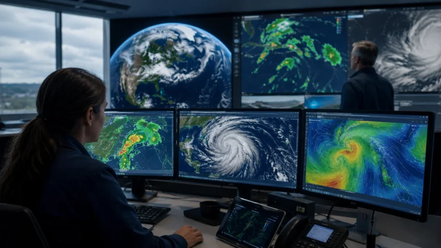
Collecting observations is only the beginning. Scientists feed enormous amounts of atmospheric data into sophisticated computer models that use mathematical equations to simulate how air, moisture, heat, pressure, and wind may change over time. These numerical weather prediction models calculate possible future conditions across millions of locations, helping meteorologists estimate where weather systems are likely to travel and how they may strengthen or weaken.
Modern weather forecasting also depends heavily on human expertise. Meteorologists compare several forecasting models, study satellite and radar patterns, consider local terrain, and assess uncertainty before producing a final forecast. Computer models are extremely powerful, but they do not perfectly represent every cloud, mountain, coastline, or rapidly developing thunderstorm, which makes professional interpretation important.
Weather prediction has become far more sophisticated through better satellites, faster computers, improved forecasting models, and growing use of artificial intelligence. Yet uncertainty remains because Earth’s atmosphere is an extraordinarily complex system. Understanding the science behind weather forecasting helps explain why tomorrow’s forecast can be highly accurate while predictions several weeks ahead are much less certain.
What Is Weather Forecasting?
Weather forecasting is the scientific process of estimating future atmospheric conditions for a particular place and period. Meteorologists predict variables such as temperature, precipitation, wind speed, wind direction, humidity, cloud cover, atmospheric pressure, visibility, and the possibility of hazardous conditions including thunderstorms or severe weather.
A weather forecast begins with understanding the present state of the atmosphere. Scientists measure conditions at Earth’s surface, high in the atmosphere, over oceans, and from space. These observations help create a detailed picture of what is happening across a large region rather than simply describing conditions at one weather station.
Scientists then use physics and mathematics to determine how those atmospheric conditions are likely to evolve. Air moves because of differences in pressure and temperature, moisture changes between vapor, liquid, and ice, while Earth’s rotation influences large-scale circulation. Forecasting models attempt to represent these interactions mathematically.
The final forecast is usually a combination of observations, computer predictions, historical knowledge, and meteorological judgment. The result may be a simple daily temperature forecast or a sophisticated warning about extreme rainfall, damaging winds, flash flooding, tornadoes, or other hazardous weather.
Why Predicting Weather Is So Complicated
Earth’s atmosphere behaves like an enormous interconnected fluid surrounding the planet. A change in temperature, moisture, or air pressure in one area can influence wind patterns and weather systems elsewhere. Scientists therefore cannot predict local weather accurately by examining only the air immediately above one city or neighborhood.
Atmospheric conditions also change continuously. Sunshine heats Earth’s surface unevenly, oceans exchange heat and moisture with the atmosphere, mountains redirect air currents, and clouds influence temperature and radiation. These processes occur simultaneously at scales ranging from tiny cloud droplets to weather systems stretching across continents.
Another challenge is that scientists cannot measure every part of the atmosphere perfectly. Weather stations, satellites, balloons, aircraft, and radar provide enormous amounts of information, but gaps remain. Computer models must estimate conditions between observation points before calculating how the atmosphere may develop.
Small differences in the atmosphere can eventually produce much larger differences in future weather. This sensitivity is one reason forecast uncertainty generally increases with time. A forecast for tomorrow begins from observations close to the present, while a forecast many days ahead depends on numerous earlier calculations and assumptions.
Step 1: Scientists Observe Current Weather Conditions
Weather prediction begins by observing what is happening right now. Meteorologists collect measurements from thousands of instruments positioned across land, oceans, and the atmosphere. These observations provide information about temperature, wind, humidity, pressure, clouds, rainfall, and other conditions that influence future weather.
Surface weather stations are among the most familiar observation systems. They measure variables such as air temperature, relative humidity, wind speed, wind direction, atmospheric pressure, and precipitation. Networks of stations allow scientists to compare conditions across cities, rural areas, deserts, mountains, and coastlines.
Observations over oceans are equally important because large weather systems frequently develop or strengthen over water. Ships, drifting buoys, fixed buoys, and other marine platforms provide measurements of sea temperature, air pressure, winds, waves, and atmospheric conditions far from traditional land stations.
Scientists combine these measurements into a broad snapshot of the atmosphere. The more accurate that starting picture becomes, the better numerical models can estimate what happens next. This is why improvements in weather observation technology can directly contribute to improvements in forecast accuracy.
How Weather Stations Help Meteorologists
Weather stations provide continuous measurements close to Earth’s surface, where people experience most weather directly. Instruments at these sites can detect changing temperature, falling atmospheric pressure, increasing humidity, rainfall, and shifting winds that may indicate an approaching front or developing storm.
Thermometers measure air temperature, while barometers measure atmospheric pressure. Hygrometers measure humidity, anemometers measure wind speed, and wind vanes identify wind direction. Rain gauges record precipitation, giving meteorologists essential information about how much rain or melted snow has fallen in a particular location.
Automatic weather stations can transmit observations frequently without requiring someone to manually record each measurement. This allows forecasting centers to receive updated data throughout the day and quickly identify changes that might indicate developing severe weather or an unexpected shift in atmospheric conditions.
Individual stations provide local information, but their real value increases when data from many stations are combined. Meteorologists can map pressure systems, temperature boundaries, fronts, and wind patterns across large regions, helping them understand how different air masses and weather systems are interacting.
How Weather Balloons Measure the Upper Atmosphere
Surface observations cannot reveal everything happening several kilometers above the ground. Weather balloons help solve this problem by carrying specialized instruments known as radiosondes through the atmosphere. As the balloon rises, the instruments transmit measurements back to receiving stations.
Radiosondes commonly measure temperature, humidity, atmospheric pressure, wind speed, and wind direction at different altitudes. These vertical profiles help scientists understand how atmospheric conditions change from the surface into the upper atmosphere, where powerful winds and temperature patterns strongly influence weather systems.
Upper-air measurements are particularly valuable for identifying atmospheric instability. Meteorologists can examine how quickly temperature decreases with height and how moisture is distributed through the atmosphere. These conditions help determine whether thunderstorms, heavy rainfall, or other forms of active weather may develop.
Weather-balloon observations are also incorporated into computer forecasting models. Although satellites provide extensive global coverage, direct measurements from balloons remain valuable because they provide detailed vertical information about atmospheric conditions that influences both short-term and longer-range weather predictions.
How Weather Satellites Predict Weather
Weather satellites allow scientists to observe enormous sections of Earth from space. They provide continuous information about cloud patterns, storms, atmospheric moisture, temperature, wildfires, sea-surface conditions, snow cover, and other features that influence weather forecasting across regions where surface observations may be limited.
Some satellites remain positioned so they continuously observe the same broad region of Earth. Their frequent images allow meteorologists to watch thunderstorms develop, clouds rotate around tropical cyclones, and weather systems move across continents and oceans. This continuous monitoring is particularly important during rapidly changing severe weather.
Other satellites orbit the planet and collect detailed measurements as they repeatedly pass over different regions. Their instruments can measure atmospheric temperature and moisture at various levels, providing valuable information that is fed into numerical weather prediction systems.
Satellite imagery also helps meteorologists identify patterns that may not be obvious from surface measurements alone. Changes in cloud shape, temperature, moisture, and movement can reveal strengthening storms, developing tropical systems, jet-stream features, and other atmospheric processes before their effects reach populated areas.
How Weather Radar Tracks Rain and Storms
Weather radar is one of the most important tools for monitoring precipitation and thunderstorms in real time. Radar systems send pulses of electromagnetic energy into the atmosphere and measure signals reflected back by raindrops, snowflakes, hailstones, and other precipitation particles.
The strength of the returning signal can help meteorologists estimate where precipitation is occurring and how intense it may be. Radar images can show the location of rain, snow, and thunderstorms with far more local detail than many satellite images, making radar particularly useful for short-term forecasting.
Modern Doppler radar can also measure motion toward or away from the radar site. This capability helps meteorologists analyze wind patterns within storms and identify areas of rotation that could indicate developing tornadoes or other dangerous forms of severe weather.
Radar observations change rapidly as storms develop, move, weaken, or intensify. Meteorologists use sequences of radar images to estimate storm direction and speed, allowing them to produce short-term warnings and forecasts for communities that may soon experience heavy rain, hail, damaging winds, or lightning.
How Aircraft Collect Weather Data
Aircraft contribute valuable atmospheric observations that complement satellites, radar, balloons, and surface stations. Commercial airplanes routinely collect information about temperature, winds, and other atmospheric variables while traveling at different altitudes and across heavily traveled regions.
These measurements help fill gaps between weather-balloon launches and provide frequent information about conditions near major flight routes. Data about high-altitude winds are especially valuable because they help scientists understand jet-stream patterns that can influence the movement of large weather systems.
Specialized research and reconnaissance aircraft can also fly into certain powerful storms. During tropical cyclones, aircraft may directly measure central pressure, winds, temperature, moisture, and storm structure, providing information that cannot always be determined precisely from satellites alone.
Aircraft data are rapidly incorporated into forecasting systems along with observations from numerous other sources. Combining many independent measurement platforms gives meteorologists a more complete picture of the atmosphere and improves the initial conditions used by computer weather models.
Step 2: Meteorologists Create a Picture of the Atmosphere
After collecting observations, scientists need to combine them into a consistent representation of atmospheric conditions. Measurements arrive at different times, locations, heights, and resolutions, so they cannot simply be placed directly into a forecasting model without additional processing.
Meteorological systems use a process called data assimilation to combine observations with information from previous forecasts. This produces an estimate of atmospheric conditions across a three-dimensional grid covering the area represented by the computer model.
Data assimilation helps fill gaps where direct measurements are unavailable. For example, a satellite may provide useful information above an ocean where relatively few surface stations exist, while nearby measurements and model physics help estimate conditions between observation points.
This starting representation is extremely important because every weather forecast develops from it. Errors in temperature, pressure, wind, or moisture at the beginning of a simulation can influence how the predicted atmosphere evolves many hours or days later.
Step 3: Computers Run Numerical Weather Prediction Models
Once scientists estimate the current condition of the atmosphere, powerful computers begin calculating what may happen next. This process is known as numerical weather prediction, and it forms the foundation of most modern weather forecasts around the world.
Numerical weather models use mathematical equations based on physical laws governing motion, energy, moisture, and atmospheric pressure. These equations describe processes such as wind flow, heat transfer, cloud formation, evaporation, condensation, and interactions between Earth’s surface and the atmosphere.
Because it is impossible to calculate conditions at every individual point in the atmosphere, models divide Earth into three-dimensional grids. Each grid cell contains estimated values for temperature, humidity, wind, pressure, and other variables that change as the simulation moves forward in time.
Supercomputers repeatedly solve these equations for millions or billions of calculations. The result is a forecast showing how pressure systems, temperatures, winds, clouds, and precipitation may develop over the following hours or days.
Why Supercomputers Are Essential for Weather Forecasting
Weather forecasting involves enormous amounts of data and extraordinarily complex calculations. A modern forecasting model may represent the atmosphere at millions of locations horizontally and through numerous vertical levels extending high above Earth’s surface.
At each location, the computer must calculate changes in multiple atmospheric variables. These calculations interact with neighboring grid cells, meaning one simulated change in wind or temperature can influence subsequent calculations across a much larger area.
Faster computers allow scientists to increase model resolution and represent smaller atmospheric features more accurately. Higher-resolution models can provide better details about coastlines, mountains, thunderstorms, local winds, and precipitation patterns than coarser simulations.
Computing power also allows forecasting centers to run several models or multiple versions of the same model. Instead of relying on one possible future, scientists can compare many simulations, giving them a better understanding of forecast confidence and possible alternative outcomes.
What Weather Models Actually Predict
Numerical weather models calculate numerous atmospheric variables rather than simply predicting whether it will rain. They estimate future temperature, pressure, humidity, wind direction, wind speed, cloud cover, rainfall, snowfall, atmospheric stability, and other conditions across many geographical locations.
Meteorologists can display these calculations as maps showing fronts, high- and low-pressure systems, wind patterns, and precipitation. By examining how those features change from one forecast hour to another, forecasters can estimate the movement and development of major weather systems.
Different models have different resolutions, mathematical approaches, geographic coverage, and strengths. Some focus on global weather patterns, while others provide higher-resolution forecasts for smaller regions where detailed information about thunderstorms, mountains, or coastlines may be especially important.
Meteorologists rarely rely on one model prediction without comparison. Agreement between several models can increase confidence, while significant disagreement signals greater uncertainty and encourages forecasters to consider multiple possible scenarios.
What Are Global and Regional Weather Models?
Global weather models simulate atmospheric conditions across the entire planet. They are particularly useful because weather systems do not respect national borders, and changes occurring thousands of kilometers away can eventually influence local conditions.
Because global models cover such an enormous area, their resolution may be less detailed than specialized regional models. However, they provide essential information about large-scale patterns such as jet streams, oceanic storms, pressure systems, and tropical weather.
Regional models cover smaller geographical areas but can operate at finer resolution. This allows them to represent local terrain, coastlines, thunderstorms, and other smaller-scale features in greater detail, which can improve short-term forecasts for specific areas.
Forecasters often use global and regional models together. A global model provides the large atmospheric picture, while higher-resolution simulations can help refine local expectations for rainfall, wind, temperature, and severe weather.
What Are Ensemble Weather Forecasts?
A single forecast model produces one possible version of the future, but scientists know that uncertainty exists in the starting observations and in the model itself. Ensemble forecasting addresses this problem by running many slightly different simulations.
Each ensemble member begins with small variations in atmospheric conditions or model settings. If nearly every simulation predicts a similar outcome, meteorologists may have greater confidence that the general weather pattern is likely to occur.
If ensemble members produce very different results, forecast confidence is lower. For example, some simulations might predict a storm passing north of a city while others move it farther south, indicating meaningful uncertainty in the storm’s future track.
Ensemble forecasts allow meteorologists to communicate probabilities rather than presenting one prediction as absolute certainty. They are especially valuable for forecasts several days ahead, when small differences in current atmospheric conditions can eventually produce substantially different weather outcomes.
Step 4: Meteorologists Interpret the Computer Models
Computer models provide enormous amounts of useful information, but meteorologists still play a central role in weather prediction. Forecasters analyze model output alongside radar, satellite images, observations, and their knowledge of atmospheric processes.
Experienced meteorologists understand that models may perform differently under particular weather conditions. One model may handle certain storm systems effectively but struggle with local rainfall or terrain effects, while another may produce systematically warmer or colder temperatures in specific situations.
Forecasters also recognize local influences that may not be perfectly represented by computer simulations. Mountains can alter wind and precipitation, lakes may influence snowfall, coastlines affect temperature, and cities can create localized heating that changes near-surface conditions.
By comparing observations with model predictions, meteorologists can determine whether simulations are accurately representing current conditions. They may then adjust the forecast when evidence suggests that a particular model outcome is less realistic than another.
How Meteorologists Predict Rain
Forecasting rain requires understanding how much moisture exists in the atmosphere and whether air will rise enough for that moisture to condense into clouds and precipitation. Meteorologists examine humidity, temperature profiles, pressure systems, fronts, and atmospheric instability.
Weather models estimate where rising motion and sufficient moisture may occur. Satellite images can reveal developing cloud systems, while radar provides detailed information once precipitation begins falling or storms become organized enough to detect.
Terrain can significantly affect rainfall forecasts. Moist air forced upward over mountains can cool and produce precipitation, while areas on the opposite side may remain much drier. Coastlines and local wind circulations can also influence where showers and thunderstorms form.
Because rainfall can vary considerably across short distances, forecasts are often expressed as probabilities. A chance of rain represents the likelihood of measurable precipitation at a location during a specified forecast period rather than indicating how long rain will last.
How Scientists Predict Temperature
Temperature forecasting begins with current observations and information about how air masses are likely to move. Meteorologists examine cloud cover, wind direction, humidity, incoming solar energy, soil conditions, snow cover, and other factors affecting heating and cooling.
Clear skies can allow stronger daytime heating but may also lead to greater nighttime cooling. Clouds often reduce daytime warming by blocking sunlight while limiting overnight cooling by trapping some heat near Earth’s surface.
Wind direction also matters because winds transport air from different regions. A shift to northerly winds may bring colder air into some locations, while winds arriving from warmer regions can increase temperatures significantly within a relatively short time.
Local geography further influences temperature. Coastal areas may experience smaller temperature changes because water warms and cools slowly, while valleys can trap cold air overnight. Meteorologists consider these local effects when refining temperature forecasts from broader computer models.
How Meteorologists Predict Thunderstorms
Thunderstorms require moisture, instability, and a mechanism that lifts air upward. Meteorologists examine these ingredients to determine whether thunderstorms are likely and whether some storms could become severe.
Atmospheric instability occurs when warm air near the surface can continue rising after being lifted. Weather balloons and numerical models help forecasters analyze temperature and moisture at different altitudes to determine how unstable the atmosphere may become.
Wind shear is another important factor for severe thunderstorms. Changes in wind speed or direction with height can organize storms, allowing them to persist longer and potentially produce damaging winds, large hail, or tornadoes.
Radar and satellite observations become especially important once thunderstorms begin developing. Forecasters watch how quickly storms intensify, where they are moving, and whether signs of rotation or other dangerous structures are appearing.
How Scientists Predict Hurricanes
Hurricane forecasting begins long before a tropical system becomes a named storm. Satellites monitor tropical oceans for clusters of thunderstorms, rotating cloud patterns, atmospheric moisture, and disturbances that could potentially become tropical cyclones.
Once a tropical cyclone develops, scientists combine satellite observations, ocean measurements, aircraft reconnaissance, and computer models to estimate its current intensity and predict its future movement. Atmospheric pressure systems surrounding the cyclone strongly influence its track.
Forecasting hurricane intensity can be more difficult than forecasting its general path. Small changes in ocean temperature, moisture, wind shear, or the storm’s internal structure can cause unexpected strengthening or weakening.
Meteorologists therefore provide forecast tracks along with uncertainty information rather than implying the exact future path is guaranteed. Communities near the projected track are encouraged to follow updated forecasts because relatively small shifts can significantly change local impacts.
How Scientists Predict Snow
Snow forecasting requires determining whether temperatures will be cold enough throughout the atmosphere for frozen precipitation to reach the surface. A surface temperature near freezing does not automatically mean snow will occur because conditions at higher altitudes are equally important.
Meteorologists examine vertical temperature profiles using weather balloons and computer models. If snowflakes fall through a sufficiently deep layer of warmer air, they can melt into rain, while different temperature structures can produce sleet or freezing rain.
Predicting snowfall amounts adds another challenge because the amount of snow produced from a given quantity of liquid water varies considerably. Temperature, crystal structure, wind, and atmospheric moisture all influence snow density.
Terrain can further complicate forecasts because mountains enhance precipitation in some regions and reduce it in others. Small changes in storm track can therefore produce large differences in snowfall totals between communities located relatively close together.
What Role Does Atmospheric Pressure Play?
Atmospheric pressure represents the force exerted by the air above a particular location. Differences in pressure help drive winds and strongly influence the development and movement of weather systems.
Low-pressure areas are commonly associated with rising air. As air rises and cools, moisture may condense into clouds and precipitation, making low-pressure systems frequently associated with unsettled or stormy weather.
High-pressure systems generally contain sinking air that discourages cloud development. They are often associated with clearer and more stable conditions, although temperatures under high pressure can vary considerably depending on season and location.
Meteorologists track how high- and low-pressure systems move and change because their positions help determine wind direction, temperature, and precipitation. Pressure maps remain fundamental tools even in an era dominated by satellites and sophisticated numerical models.
What Is the Jet Stream and Why Does It Matter?
The jet stream is a relatively narrow zone of powerful winds high in the atmosphere. These winds generally move from west to east and can strongly influence the direction and speed of major weather systems.
Large bends in the jet stream can transport warm air toward higher latitudes and cold air toward lower latitudes. These patterns help create significant temperature changes and influence the development of storms and pressure systems.
Meteorologists closely monitor the position, strength, and shape of jet-stream winds when making forecasts several days ahead. Changes in the upper atmosphere can determine whether a storm moves quickly, slows down, strengthens, or follows a different path.
Because the jet stream influences large-scale atmospheric circulation, accurately predicting its evolution is crucial for medium-range forecasting. Errors in predicting an upper-level pattern can eventually produce noticeable differences in surface forecasts several days later.
How Geography Changes Local Weather Forecasts
Local geography can make weather forecasting more complicated because computer models cannot represent every hill, valley, building, or coastline perfectly. Mountains are particularly influential because they force air to rise and can dramatically affect precipitation and temperature.
Coastal regions often experience sea breezes created by differences in how quickly land and water heat. These local winds can change temperatures, cloud cover, and thunderstorm development across relatively short distances.
Large lakes can also influence weather by adding heat and moisture to passing air masses. Under favorable winter conditions, this process can contribute to intense localized snowfall on the downwind side of a lake.
Cities create additional effects because concrete, asphalt, buildings, and human activity can make urban environments warmer than surrounding rural areas. Meteorologists incorporate local knowledge and increasingly detailed models to account for these differences.
How Artificial Intelligence Is Changing Weather Prediction
Artificial intelligence is becoming an increasingly important tool in atmospheric science. Machine-learning systems can analyze enormous historical and real-time datasets, recognize complex patterns, and help produce weather predictions with remarkable computational efficiency.
Some AI-based forecasting approaches learn relationships between past atmospheric conditions and how weather evolved afterward. Once trained, these systems may generate certain large-scale predictions much faster than traditional numerical models that repeatedly solve complex physical equations.
Artificial intelligence can also support specific forecasting tasks such as identifying severe-weather patterns, improving precipitation estimates, processing satellite information, correcting model biases, and generating localized predictions from broader forecast data.
AI does not eliminate the need for atmospheric observations, physical science, or professional meteorologists. Weather agencies and researchers increasingly view machine learning as another powerful forecasting approach that can complement traditional physics-based models and help scientists understand uncertainty.
Why Weather Forecasts Sometimes Change
People sometimes assume that a changing forecast means meteorologists made a simple mistake. In reality, forecasts are continuously updated because new observations provide better information about how the atmosphere is actually evolving.
A storm may move slightly faster or slower than models previously predicted. A front may shift farther north, thunderstorms may develop earlier, or clouds may persist longer than expected, changing temperature and rainfall predictions.
Computer models are rerun repeatedly with newly collected data. Each updated simulation begins from a more recent estimate of atmospheric conditions, so the expected future can change as scientists gain information that was unavailable during the previous forecast.
Changing forecasts therefore reflect the scientific process of incorporating new evidence. When uncertainty is high, responsible forecasting means adjusting predictions rather than continuing to present an older forecast that current observations no longer support.
Why Short-Term Forecasts Are Usually More Accurate
Weather forecasts for the next several hours or days begin with atmospheric conditions relatively close to the present. Scientists have detailed observations of those conditions, allowing computer models to start from a reasonably accurate representation of reality.
As the forecast extends further into the future, small uncertainties grow. A slight error in the position of a pressure system today can eventually affect predictions of wind, clouds, temperature, and precipitation several days later.
This does not mean longer-range forecasts are useless. Meteorologists can often predict broad weather patterns considerably farther ahead, such as whether a period is likely to be warmer, cooler, wetter, or more unsettled than usual.
However, specific details become less reliable with increasing lead time. Predicting the exact timing and location of a thunderstorm two weeks in advance is far more difficult than predicting a broad regional weather pattern over the same period.
Why Weather Forecasts Are Given as Probabilities
Atmospheric uncertainty means many forecasts are best communicated as probabilities rather than absolute statements. Rain forecasts are a familiar example, but probability is also relevant to temperature ranges, snowfall amounts, storm tracks, and severe-weather risks.
Ensemble models help scientists estimate these probabilities by generating numerous possible atmospheric futures. When most simulations support the same outcome, forecast confidence generally increases.
Probability also allows meteorologists to communicate risk before every detail becomes certain. A low-probability but potentially dangerous event may still deserve attention when the consequences of being unprepared would be serious.
Understanding uncertainty makes forecasts more useful rather than less trustworthy. Weather science cannot eliminate all unknowns, but modern forecasting can often estimate how confident scientists are in different possible outcomes.
What Is Nowcasting?
Nowcasting refers to weather prediction over the immediate future, typically focusing on conditions developing over the next several minutes or hours. It is especially useful for rapidly evolving events such as thunderstorms, intense rain, hail, fog, and snow showers.
Radar plays a central role because it allows meteorologists to see precisely where precipitation is moving. Satellite imagery, lightning detection, weather stations, and other real-time observations provide additional information about changes in storms and surrounding atmospheric conditions.
Computer algorithms can track individual storm cells and estimate where they may move shortly afterward. Meteorologists then interpret these predictions alongside observed changes in storm intensity and organization.
Nowcasting can provide highly valuable information for outdoor events, transportation, aviation, emergency management, and severe-weather warnings. However, rapidly developing thunderstorms can still change unexpectedly, making continuous monitoring essential.
How Climate Forecasts Differ From Weather Forecasts
Weather forecasting predicts atmospheric conditions over relatively short periods, while climate science examines long-term patterns and statistical tendencies. A weather forecast might estimate tomorrow’s temperature, while a climate projection investigates how average temperatures may change over decades.
Scientists therefore use different methods and questions when studying weather and climate. Weather models attempt to determine the specific evolution of the atmosphere from current conditions, while climate models focus more heavily on long-term interactions and averages.
A warmer long-term climate does not tell scientists exactly whether it will rain in a particular city on one future afternoon. Similarly, a cold winter day does not by itself reveal the direction of long-term global climate trends.
Understanding this distinction prevents confusion between daily weather variability and climate change. Both fields use physics, observations, mathematics, and computer models, but their goals and time horizons are fundamentally different.
How Weather Forecasting Has Improved
Early weather forecasts relied primarily on local observations and knowledge of recurring atmospheric patterns. Telegraph communication later allowed weather information from distant locations to be collected and compared, making larger-scale forecasting increasingly practical.
Radar, satellites, weather balloons, aircraft observations, and automated stations dramatically expanded scientists’ ability to observe the atmosphere. These technologies allowed meteorologists to track storms over oceans and remote regions that previously contained very little direct information.
Advances in computing transformed forecasting even further. Modern numerical models perform extraordinary numbers of calculations and simulate atmospheric processes at resolutions that earlier generations of scientists could not have realistically achieved.
Today, improvements continue through higher-resolution models, better observations, ensemble prediction, artificial intelligence, and more powerful computing systems. Forecasts remain imperfect, but modern meteorology provides earlier and more detailed information about many dangerous weather events than was possible in the past.
Why Human Meteorologists Still Matter
Weather forecasting is sometimes described as if computers automatically produce the final answer, but meteorologists remain essential. Computer models generate predictions, while trained forecasters assess whether those predictions make physical sense and how much confidence should be placed in them.
Meteorologists compare several models and identify patterns in their agreement or disagreement. They also examine whether models correctly represent current conditions, because a simulation that begins with significant errors may produce a less reliable forecast.
Local expertise can be especially valuable. Forecasters familiar with regional mountains, coastlines, urban areas, and recurring weather patterns may recognize circumstances in which a computer model consistently struggles.
Human communication is equally important during dangerous weather. Meteorologists translate complex scientific information and uncertainty into practical forecasts and warnings that communities, emergency managers, businesses, and individuals can understand and use.
Final Thoughts on How Scientists Predict the Weather
So, how do scientists predict the weather? They begin by collecting an enormous amount of information about the atmosphere from weather stations, satellites, radar, balloons, aircraft, ships, and ocean buoys. Those observations establish the best possible picture of current atmospheric conditions.
The data are then processed and entered into numerical weather prediction models that simulate how temperature, wind, moisture, pressure, clouds, and precipitation may change. Supercomputers perform the enormous number of calculations required to create forecasts extending from hours to days into the future.
Meteorologists compare different models, study ensemble forecasts, monitor real-time observations, and apply scientific expertise before communicating the final forecast. Increasingly, artificial intelligence and machine learning provide additional ways to analyze atmospheric data and generate useful predictions.
Weather forecasting will never be perfectly certain because Earth’s atmosphere is dynamic and extremely complex. However, improvements in observations, computing, physics, and AI continue making predictions more useful, helping people plan daily life and prepare earlier for potentially dangerous weather.
Frequently Asked Questions
How do scientists predict the weather?
Scientists collect atmospheric data from satellites, radar, weather stations, balloons, aircraft, and buoys. They combine these observations with computer models and meteorological expertise to estimate future conditions.
How accurate are weather forecasts?
Short-term forecasts are generally more reliable because they begin closer to known atmospheric conditions. Accuracy gradually decreases as forecasts extend further into the future and uncertainty grows.
What computers are used to predict weather?
Meteorological organizations use powerful supercomputers to run numerical weather prediction models. These machines perform massive calculations involving temperature, pressure, wind, moisture, and other atmospheric variables.
How do satellites help predict the weather?
Weather satellites observe clouds, storms, temperature, moisture, and other atmospheric features across large areas. Their measurements help scientists monitor current weather and improve the starting data used in forecasting models.
Can AI predict the weather?
Yes. Artificial intelligence and machine learning can analyze atmospheric patterns and generate useful weather predictions. AI increasingly complements traditional physics-based forecasting rather than completely replacing meteorologists or numerical models.